Keynote speakers

Sofia Cilla obtained a PhD in Physics by the University of Zaragoza, Spain. She joined GMV (aero-spatial company within the private sector) when European GNSS space programs where just starting the design phase. She worked on the development of EGNOS and GALILEO for more than eight years. On 2009 she joined ESSP, the company that has been providing EGNOS service since it became operational. She has been involved in different activities, from performance analysis to setting up a receiver lab. She is now managing the team in charge of fostering EGNOS adoption for all markets (aviation, maritime, surveying, agriculture and rail), and being directly involved in the activities to increase EGNOS awareness within European farming community.
GNSS and EGNOS (SBAS) for farming: all you need to know from this European free service
Nowadays, tractor guidance is a key technology for farmers: it lowers crop cost thanks to savings in chemicals as it reduce skips and overlaps, especially when relying on visual estimation of swath distance and/or counting rows. Global Navigation Satellite System are the core technology on which tractor guidance relies. In this presentation European GNSS will be introduced. The focus will be placed in EGNOS, which will be described in detail providing all the practical aspects that the practitioners (advisors, manufacturers, farmers, etc. need to know: equipment configuration guides available (and where to find them), how to contact for receiving free support and many other tools (cost assessments, performance maps, success stories etc). The presentation will also focus on the current services associated with EGNOS and their evolution in the future. the latter will allow the ECPA scientific community to assess the potential of future projects in precision agriculture on the basis of the free correction services offered by EGNOS.

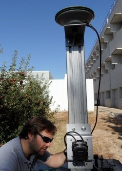
Alexandre Escolà attended the studies of Agricultural Technical Engineering (equivalent to a degree) and Agronomy Engineering (equivalent to a Master Science) at the School of Agrifood and Forestry Science and Engineering of the University of Lleida, Catalonia. His degree and master theses were related to the use of sensors to enhance applications of pesticides in fruit orchards. This work was completed in 2010 with a Ph.D. thesis entitled “Method for real-time variable rate application of plant protection products in precision horticulture/fruticulture”. In 2001, he was employed as part-time assistant professor and since 2006 as a full-time Professor Col·laborador (equivalent to assistant professor). From 2013 he is a Professor Agregat (equivalent to associate professor) at the same center. His research is carried out in the GRAP, the Research Group on AgroICT & Precision Agriculture of the University of Lleida-Agrotecnio Center. His research lines focuses on electronic characterization of vegetation, especially in fruticulture and viticulture, soil surveying and in Precision Agriculture in general to provide advisors and farmers with useful information to help them in the decision-making process. Regarding his teaching, he is member and Academic Secretary of the Department of Agricultural and Forest Engineering. Currently, he teaches courses of Precision Agriculture, Mechatronics, Computers and Agricultural Robotics at the School of Agrifood and Forestry Science and Engineering and at the Polytechnic School of the University of Lleida.
Challenges and opportunities of 3D data in Agriculture
3D information on crops and even on animals is an important issue in agriculture. Basic geometric measurements (i.e. height, width and volume) as well as structural measurements (tree training, woody structure and canopy porosity) have always been taken in the fields, orchards and in animal farms since they are considered of importance in the decision making process for several purposes. The recent explosive technological development of sensors, robotics, computers and processing techniques have turned 3D electronic characterization of farms into a quite affordable means to obtain detailed information of the whole farm in an easy, objective and repeatable way. The keynote will discuss the current and possible future solutions to obtain 3D data in agriculture, their processing requirements and their current and potential use in the decision making stage of the Precision Agriculture cycle.

Jean-Baptiste Féret obtained his degree in Agronomy Engineering from the International Center for Higher Education in Agricultural Sciences (Montpellier SupAgro, France) in 2005 and specialized in information and communication technologies applied to agriculture (AgroTIC). He worked on the characterization of soils properties in Mediterranean vineyards using hyperspectral remote sensing during his Master thesis. He specialized on physical modeling of vegetation during his PhD and obtained his Ph.D. degree in Environmental Sciences from Université Pierre et Marie Curie – Paris 6, France in 2009, entitled “Contribution of physical modeling for the estimation of leaf pigment content using remote sensing”. He developed the latest versions of the PROSPECT leaf model since then: PROSPECT-5 and PROSPECT-D. He worked as post-doctoral researcher in Asner Lab (Department of Global Ecology, Carnegie Institution for Science, Stanford, CA) from 2010 to 2014 where he became project leader for biodiversity mapping for the Carnegie Airborne Observatory project. In 2014, he was funded by the French space agency (CNES) and worked at CESBIO (Toulouse, France), on the preparation of hyperspectral satellite missions. He particularly focused on applications related to the monitoring of tropical biodiversity with a combination of 3D radiative transfer models and image processing tools. He is affiliated with the National Research Institute of Science and Technology for Environment and Agriculture (Irstea) since 2014, and works at the TETIS joint research unit. His main research interests are focused on i) improving leaf scale modeling as well as the integration of multiple data sources (such as LiDAR & spectroscopy) into complex 3D canopy models (DART) in order to broaden their domain of application for heterogeneous canopies, and ii) developing methods combining physical modeling and machine learning for the monitoring of natural and monitored ecosystems based on their biophysical properties.
Linking Remote Sensing with physical modelling of vegetation to characterize vegetation status and development: methods, challenges and perspectives
Physical modeling plays an important role in precision agriculture and vegetation monitoring based on remote sensing. The increasing capacity to account for both structural and biochemical properties into improved modeling tools now broadens the potential of operational applications beyond homogeneous crop surfaces, and brings new perspectives for fine scale monitoring, such as close range remote sensing for disease detection, and explicit 3D representation of heterogeneous vegetation covers. This presentation will introduce recent advances in physical modeling of vegetation, its integration into current remote sensing data sources (such as Sentinel-2 data and UAVs), and the combination with field information collected with complementary sensor systems.

Dr Benjamin K. Addom is the Team Leader, ICTs for Agriculture at the Technical Centre for Agricultural and Rural Cooperation (CTA). He is an expert in digital solutions for agriculture (digitalisation in agriculture). He specifically focuses on the intersection of mobile applications, remote sensing technologies and innovative business partnerships for scale and sustainability. He has over 20 years of experience with smallholder farming; extension and advisory service provision; resource mobilisation and fundraising; agribusiness development; project design and implementation; business development; and grant management.
He holds Doctorate in Information Science and Technology from Syracuse University School of Information Studies, USA; Masters in International Agriculture and Rural Development from Cornell University, USA; and Bachelors in General Agriculture from the University of Cape Coast, Ghana.
Ben had first-hand experience of smallholder agriculture in Ghana prior to secondary and college education. He then spent over 4 years as agricultural extension officer with both the public and private sector service providers in Northern Ghana. He spent 10 years in the US researching and exploring the potentials of ICTs in supporting agribusiness, extension and advisory services.
At CTA, he leads a team of 10 including Senior Programme Coordinators, Project Officers, Interns and Project Assistants. He also designs and implements ICT4Ag projects that aim at reaching the smallholder farmers on the ground. He led the technical organisation of the ICT4Ag International Conference in Kigali, 2013. He coordinated the implementation of five projects across Africa and Caribbean to understand models of ICT4Ag services provision in 2014/15. In 2015, he coordinated the implementation of two mobile platforms to overcome digital literacy and increase subscription base. He coordinated the development and deployment of the CTA’s Apps4Ag Database that has over 400 apps for agriculture. He is also currently managing a multi-million, multi-partnership, & multi-year e-extension MUIIS project in Uganda that utilizes remote sensing/satellite-based data to inform extension and advisory services to over 350,000 maize, soya bean and sesame farmers.
Making Precision Agriculture work for Smallholder Farmers
The Technical Centre for Agricultural and Rural Cooperation (CTA) based in the Netherlands has been at the forefront of promoting the development and deployment of information and communication technologies (ICTs) into the agricultural sector. This consists of facilitating the development of new applications; testing and piloting promising solutions; and supporting viable systems for scale and sustainability.
With its refreshed strategy for 2017-2020, CTA identifies digitalisation as one its three intervention areas. Within this, precision agriculture is core with the goal of assisting smallholder farmers increase productivity and profitability. This is done through a number of projects that take advantage of remote-sensing tools (satellite data, drones, sensors, mobile applications, and IoT devices) to provide customised information and messages for farmers on what to do, how to do it and when to do it. Providing farmers with timely information that is precise and locally relevant by deploying location-based solutions that enable producers to find relevant markets for their goods, and consumers to trace the sources of their items.
Using some of our on-going projects across Africa, Caribbean and Pacifica countries, the presentation will highlight the huge potential of these remote-sensing technologies to transform smallholder agriculture as well as challenges associated with the deployment and use of the tools.


